
Type
Commissioned Design
Year
2024
Location
Istanbul, Turkey
Role
Circuit Designer
Tools
AutoCAD · Rhino 3D · Unreal Engine 5 · USDZ
A full-scale motorsport venue designed around the natural topography of a forested coastal site in Istanbul. Rather than imposing a standard circuit template, the layout was developed by reading the terrain — using existing slope gradients, ridge lines, and valley paths to determine where corners break, where straights accelerate, and where the circuit descends into the landscape. The result is a circuit that feels embedded in its site rather than placed on it.
The design programme extends beyond the main circuit: a karting circuit nested inside the primary loop, a motocross and pump track area exploiting the steeper terrain to the south, a climbing facility integrated into the site's retaining geometry, and landscape zones threading between all circuits. The main building — a fluid, wave-form structure housing the pit straight, spectator terraces, and event spaces — anchors the north edge. The adjacent pond and meadow serve as the landscape counterpoint to the hardscape intensity of the circuits.
Following design completion, the circuit geometry was modelled in AutoCAD and Rhinoceros 3D in collaboration with a technical modeller, then brought into Unreal Engine 5 as a driveable real-time simulation — validating corner approach speeds, sightline corridors, and spatial scale from the driver's perspective before any physical commitment. The full circuit model was additionally exported as a USDZ file, enabling augmented reality viewing at any scale on iOS devices directly from a browser.
Landscape Architect · Simulation Lead
Circuit · Karting · Motocross · Climbing · Landscape
Venue Overview
Site Plan
Circuit Layout & Programme Zones

The full site reads as a layered motorsport landscape — the primary circuit wraps the perimeter, the karting loop occupies the interior plateau, and the motocross and climbing zones exploit the steeper southern terrain. The wave-form main building defines the pit straight axis, with the pond and event meadow providing public green space at the northern entry.

Full Circuit — Aerial Render
The complete venue from above — main circuit, karting, motocross, and the wave-form main building visible against the forested hillside backdrop.

Karting Circuit
The karting circuit is nested inside the primary loop, sharing the pit straight infrastructure. Tight infield corners and a mix of fast and slow sequences make it suitable for all skill levels.

Climbing Facility & Banked Entry Road
The climbing wall facility is carved into the site's retaining geometry at the lower circuit edge. The banked approach road uses the natural slope to build speed before the first main corner.

Motocross & Pump Track Zone
The motocross area exploits the steeper southern terrain — berms, jumps, and rhythm sections follow the natural contours of the hillside, keeping earthworks minimal and the experience dramatic.

Landscape Zone — Pond & Main Building
The landscape zone at the northern entry frames the arrival sequence — a naturalistic pond bordered by boulder edging and weeping willows, flanked by a lavender path leading to the main building terrace. It functions as the spatial and tonal counterpoint to the circuit hardscape.
Real-Time Simulation
Full Lap · Textured Circuit
Driveable Prototype — Complete Circuit
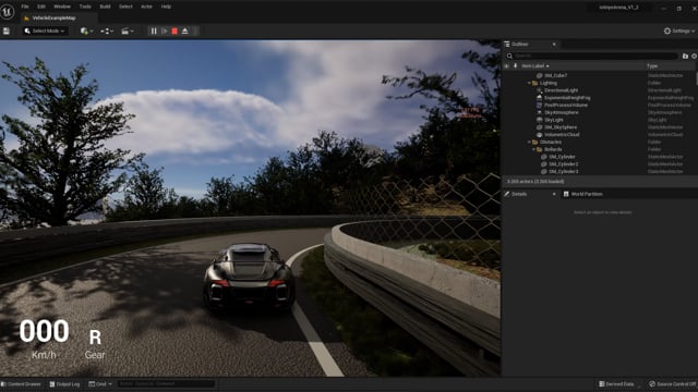
A complete timed lap of the main circuit in Unreal Engine 5, with full surface texturing, vegetation, and trackside detail applied. The simulation validates corner entry speeds, braking zones, and sightline corridors from an authentic driver perspective — spatial experience that no plan or render can replicate.
Initial Test · Basic Circuit
First Run on Circuit
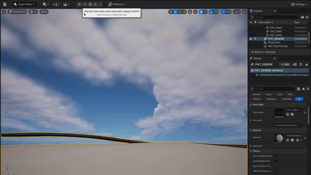
The first simulation pass on the untextured circuit geometry — testing the raw layout before visual detailing. Corner sequences, straight lengths, and elevation changes are evaluated purely for their spatial and driving quality.
Early Phase · Layout Verification
Road & Escape Route Test

An early-phase car pass through the untextured circuit, used to physically verify the placement of road edges, kerb positions, and escape route geometry. Driving the layout at this stage exposes any mismatches between the design intent and the modelled space before surface detailing locks the geometry.
X-Ray Analysis
Circuit Surroundings · X-Ray
Topographic X-Ray — Section
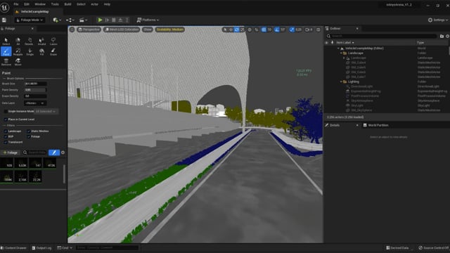
An x-ray section view through the circuit and surrounding terrain reveals the topographic relationship between the circuit surface and the underlying hillside geometry — showing how the track follows, cuts into, or rises above the natural ground plane.
Circuit Plan · X-Ray
Topographic X-Ray — Plan
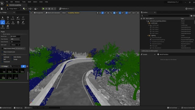
The plan x-ray strips back all surface material to show the circuit geometry floating over the terrain contours — a direct read of how closely the layout follows the site's natural lines, and where deliberate grading decisions were made.