
Surveying that once took days of tape, level, and return visits now takes a single drone flight — and comes back as a measurable, centimetre-accurate 3D model you can design against.
Category
Computational Method
Capture
DJI Mini 3 · 4K · 777 frames
Software
RealityCapture
Output
Textured mesh · GLB / USDZ
Experience
Web orbit + iOS AR
AR Experience
QR
CODE
Scan with iPhone or iPad
From the Talk
Metamesh Triennale #190 · 40:43
Photogrammetry turns a set of overlapping photographs into a measurable 3D model. By triangulating the same surface point across many frames, the software recovers where each photo was taken, builds a dense point cloud, and reconstructs a textured mesh — a faithful digital twin of a real object or site.
At small scale that means a slow orbit of photos around an object. At site scale it means a drone, flown in systematic overlapping passes. Either way the frames are aligned, reconstructed, meshed, and projected with their original photo texture.
For a landscape and computational designer this is reality capture: a way to bring existing terrain, structures, and materials into the same digital space where the design happens — accurate enough to measure, light enough to drop into AR.
01
Capture
A dense, overlapping set of frames — every surface seen from several angles, with steady, even light. On site this is a drone flying fixed-altitude orbits plus lower oblique passes.


02
Alignment · Point Cloud
The solver matches shared feature points across frames to recover each camera position, producing a sparse point cloud and a calibrated camera network.
03
Dense Mesh
The sparse cloud is densified and triangulated into a watertight mesh — millions of polygons describing the true geometry, later decimated for the web.

04
Texturing
The original photographs are reprojected onto the mesh as a high-resolution texture, so colour, material, and fine detail read correctly from every angle.
05
Output · GLB / USDZ
Exported as a lightweight GLB for web orbit and USDZ for iOS AR — small enough to stream, accurate enough to measure against the real thing.
Field Project · Drone Survey
Bozcaada
Castle Sea Wall · Sur
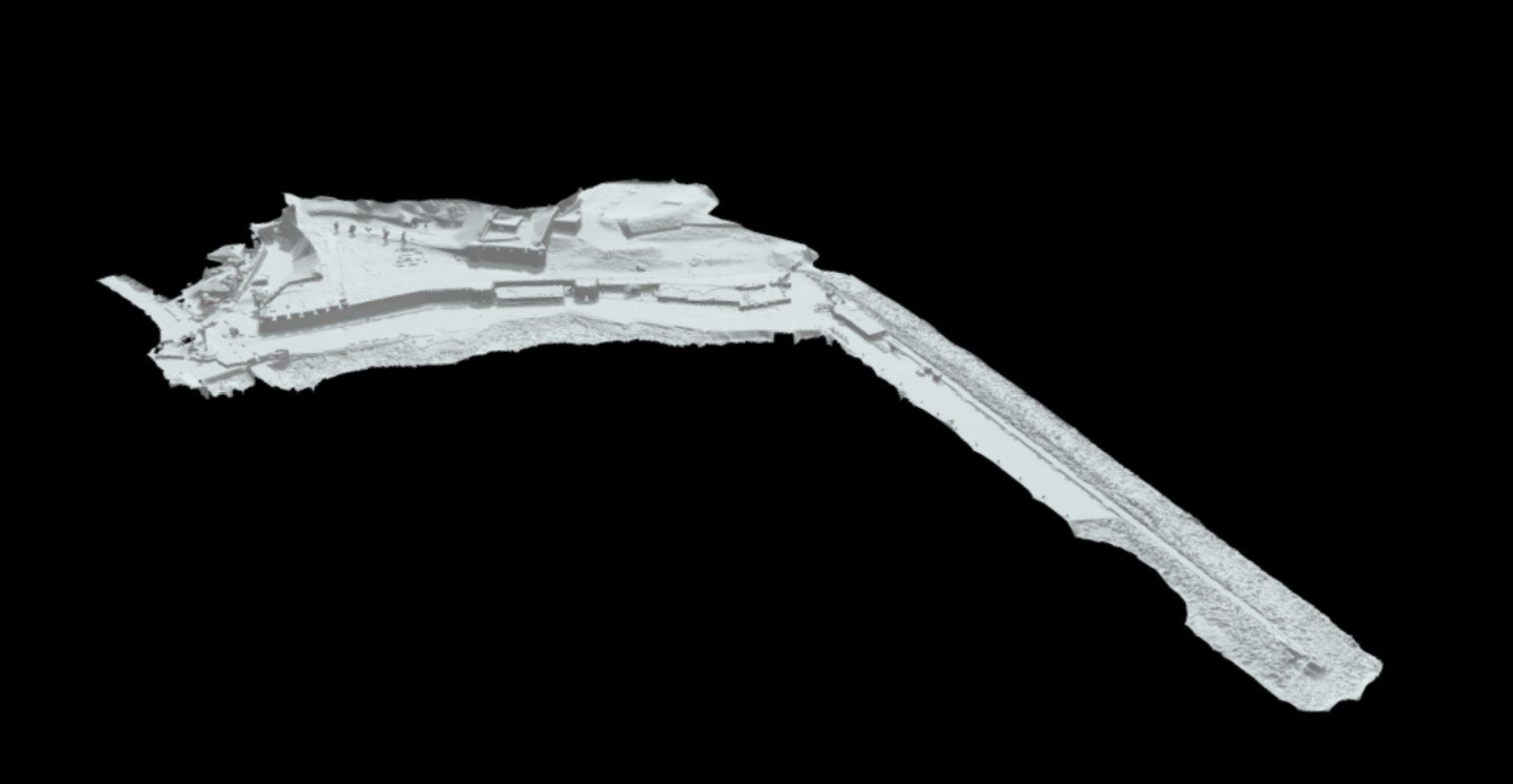
The first site-scale application: an aerial photogrammetry survey of the sea wall of Bozcaada Castle. The fortification was flown with a DJI Mini 3 in systematic overlapping passes at 4K — orbit lines at fixed altitude, then lower obliques to catch the seaward face that can't be reached on foot.
777 drone frames were aligned and reconstructed in RealityCapture, then split into three sections to keep each dense mesh manageable. The model below is section one — the seaward (kıyı şeridi) stretch — exported as a textured mesh.
Drone capture in progress — fixed-altitude orbit passes, building the frame-to-frame overlap the solver needs.
RealityCapture · Textured mesh
Sea Wall — Section 1
Drag to orbit, scroll to zoom. Drone frames aligned into a single textured mesh — geometry and colour carried straight from the photographs.
On an iPhone or iPad, tap View in AR to place the section at scale in your own space.
Reconstruction · 3 Parts
Reconstructed in three overlapping sections aligned to a common frame — shown here: section one, the seaward (kıyı şeridi) stretch.
Landscape · Computational
From Capture to Design
Captured terrain and existing structures become measurable base geometry — feeding directly into Rhino / Grasshopper for analysis and design instead of starting from a blank survey.
Material and surface studies are scanned once and reused as accurate references, and finished proposals can be handed to clients as an AR object they place on site.