 ← Work
Academic · ITU MBL · M.Sc. · 2022–23
NAR Area & The Line
Precedent Analysis · AI Diffusion · Urban Design · Esenler, Istanbul
Category
Academic Research
Year
2022–2023
Location
Esenler, Istanbul
Course
Architectural Design Futures · ITU
Instructor
Dr. İmdat Aş
Methods
Precedent Analysis AI Diffusion Modelling Urban Design
An AI-assisted urban design reimagination of the NAR Area in Esenler, Istanbul — a high-technology smart city framework developed by Ciddi Lab × Esenler Municipality as part of the city's Northern Reserve Area proposal.
The design process was grounded in a critical precedent analysis of The Line / Neom — a 170km mirrored linear smart city proposed in Saudi Arabia. Its ecological, formal, and ethical dimensions were examined to extract transferable principles for the Istanbul site.
Three design concepts were generated through AI diffusion models and applied to the existing NAR Area framework — testing how speculative urban imagery can inform a bottom-up design process that remains accountable to site, community, and ecology.
Neom · Saudi Arabia
General Overview
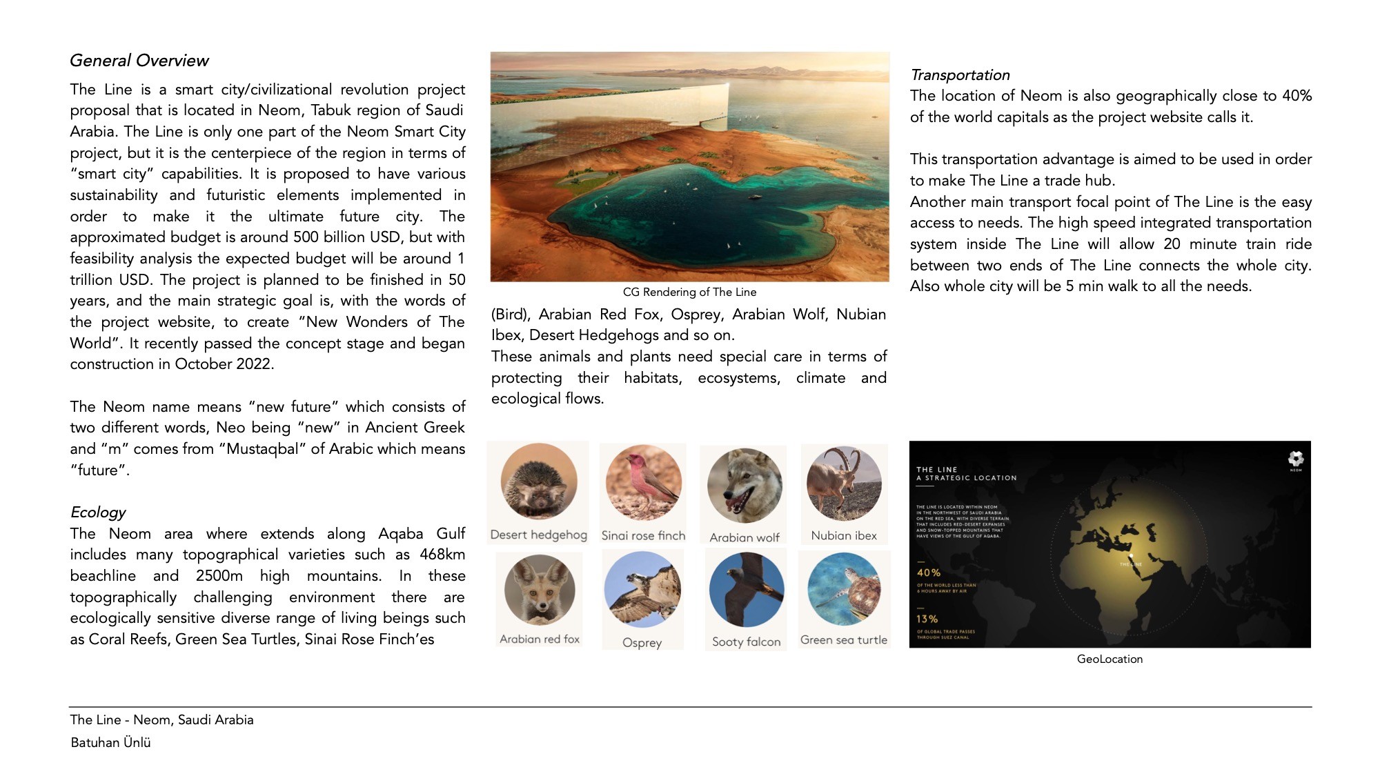
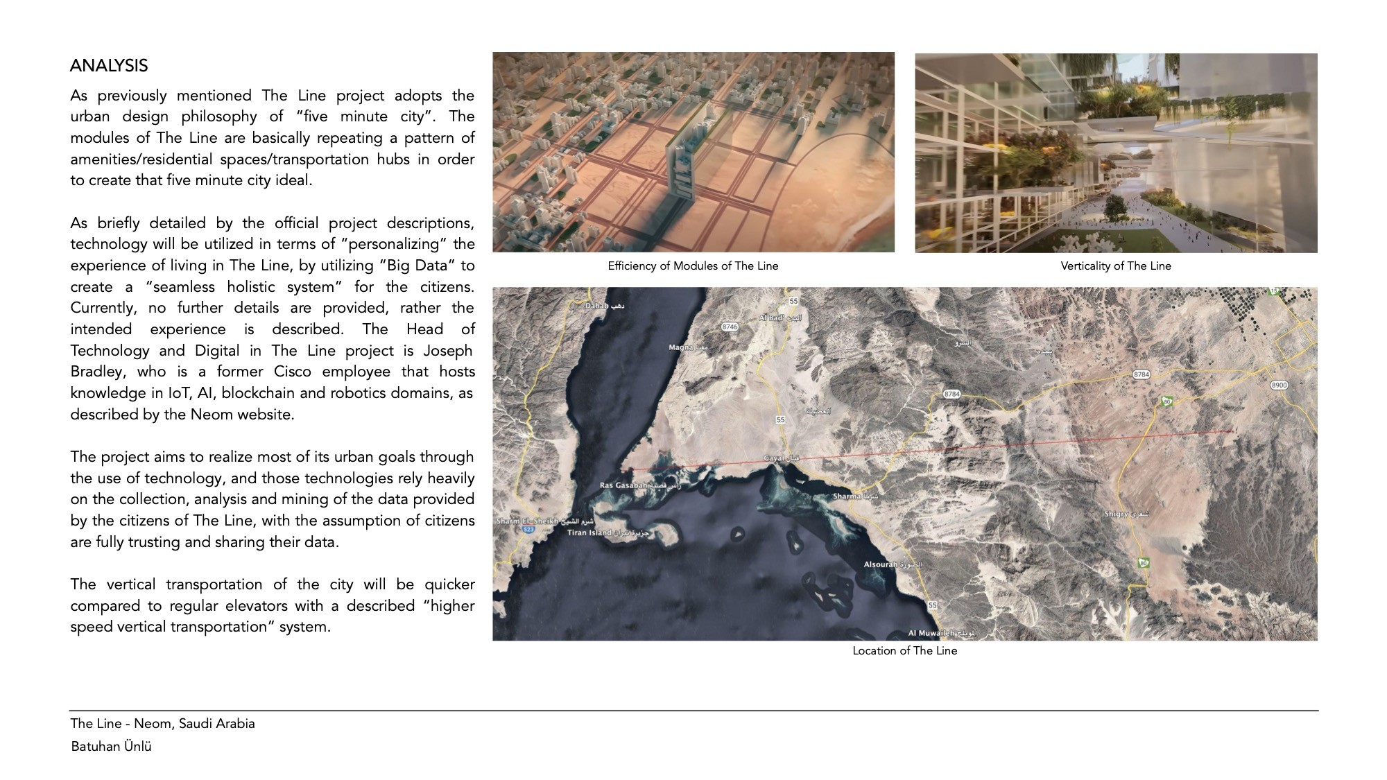
The Line is a smart city proposal in the Tabuk region of Saudi Arabia — the centerpiece of the Neom megaproject. Designed to house nine million residents in a 170km linear structure with 100% renewable energy, it is planned with an estimated budget of 1 trillion USD over a 50-year construction period.
The Neom area spans 468km of coastline and mountains reaching 2500m, sheltering ecologically sensitive species including coral reefs, green sea turtles, Arabian wolves, Nubian ibex, and the migratory Sinai rose finch — all of whose habitats are directly affected by the project footprint.
The Line · Urban Structure
Form & Sustainability
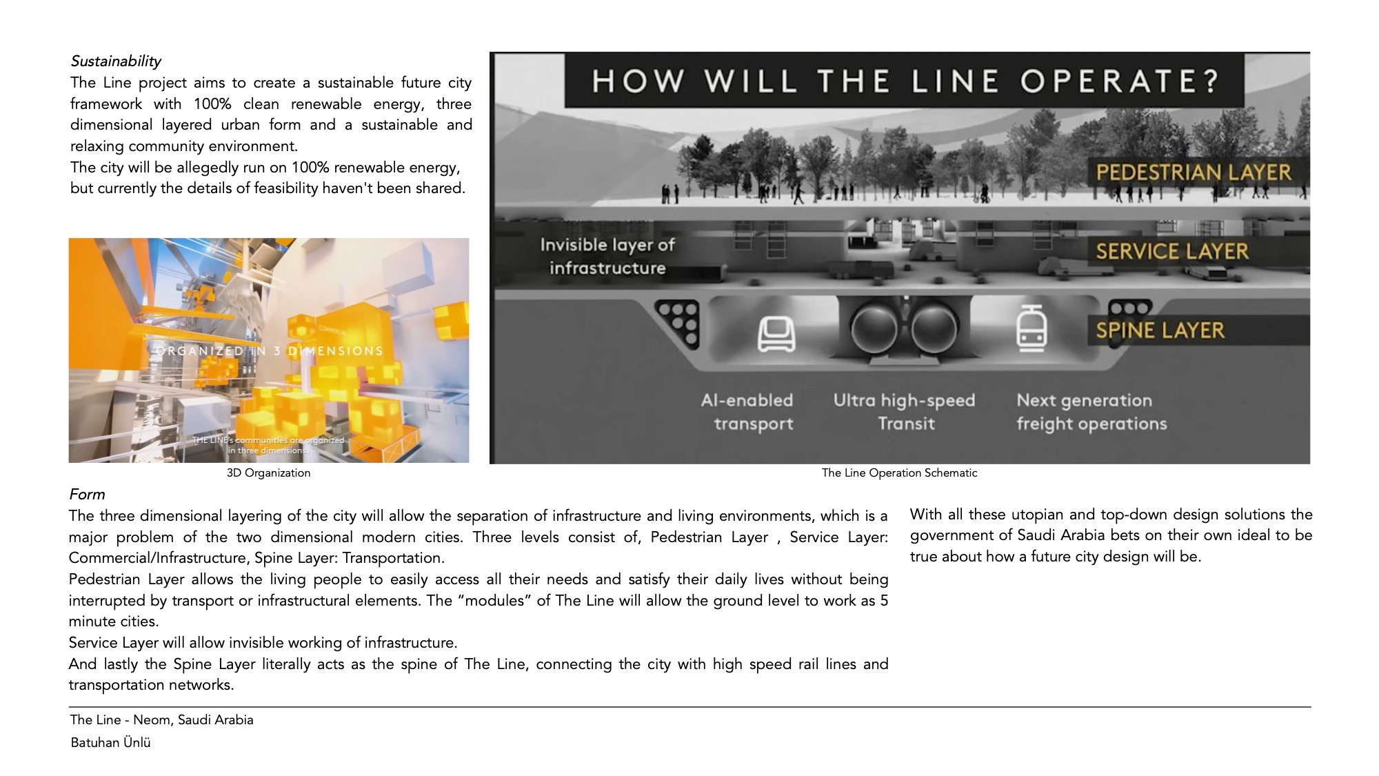
The city is organized in three vertical layers: a pedestrian layer for daily life and access to needs, an invisible service layer for infrastructure, and a spine layer for high-speed rail. This three-dimensional separation aims to resolve the fundamental conflict between movement and living that defines conventional cities.
Each module of The Line functions as a five-minute city — a repeating pattern of amenities, residential spaces, and transportation hubs promising walkable access to all daily needs. The project also proposes AI-driven personalization of spatial experience through mass collection of citizen data.
Critical Reading
Interpretation

01 — Ecology
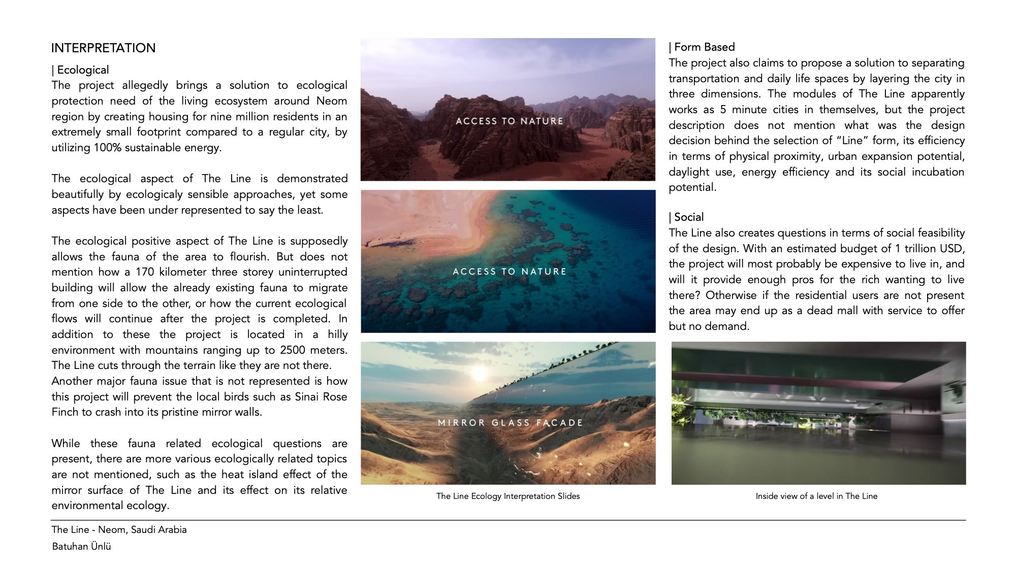
A 170km uninterrupted structure acts as an ecological barrier at every scale — blocking fauna migration, disrupting water and wind flows, and cutting through mountainous terrain that reaches 2500m. The project offers no explanation of how existing wildlife corridors would be maintained after construction.
02 — Wildlife
The mirror glass facade poses a direct bird mortality risk. A single Manhattan skyscraper caused 226 bird deaths in one migration day — The Line, at 170km, would expose migratory species including the Sinai rose finch to this risk at a scale without precedent. The heat island effect of the mirror surface on surrounding ecology is also unaddressed.
03 — Ethics
The city's AI personalization systems require citizens to share extensive personal data with the Saudi government. Meanwhile, the Huwaitat tribe — displaced from the project area during land clearance — is not mentioned anywhere in official documentation. The ethics of this displacement remain entirely unaddressed by the project.
Critical Assessment
Evaluation
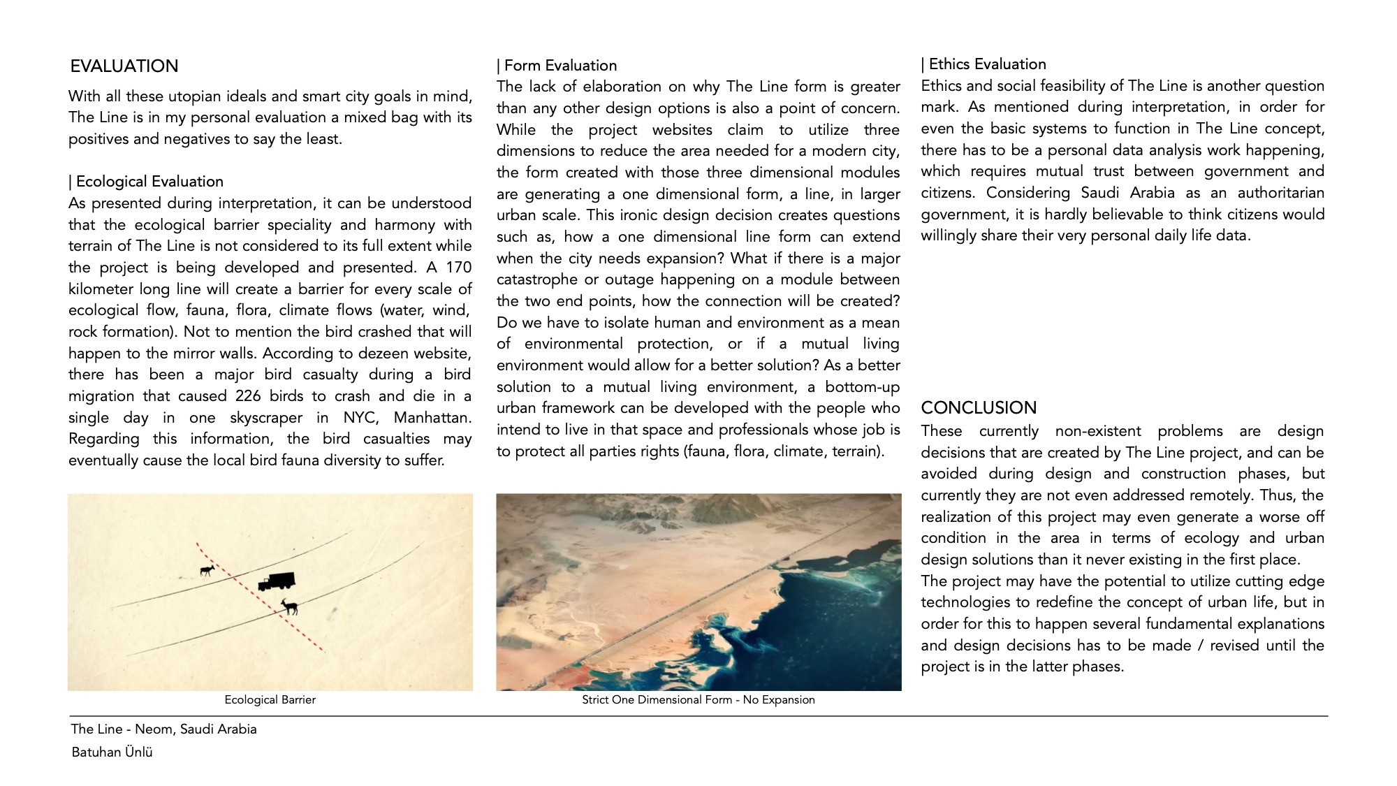
The Line's one-dimensional form cannot expand. Any failure in a module between the two endpoints severs the entire city. The project claims three-dimensional organization at module level yet produces a strictly one-dimensional urban form at city scale — an irony that is never addressed in project documentation.
As currently proposed, its realization risks generating worse ecological and urban conditions than if it had never been built. The project may have the potential to redefine urban life through cutting-edge technology — but several fundamental design decisions must first be resolved before construction advances further.
Site
NAR Area Esenler, Istanbul
Client
Ciddi Lab × Esenler Municipality
Framework
Northern Reserve Area Smart City Proposal
AI Tool
Diffusion Models (DALL-E / Midjourney)
The NAR Area is a high-technology smart urban city concept developed by Ciddi Lab × Esenler Municipality, proposed as part of Istanbul's Northern Reserve Area. The framework targets advanced social, technical, and transportation infrastructure — designed to be disaster-proof, sustainable, and livable.
The critical analysis of The Line was used as a lens to identify three design principles transferable to this Istanbul context: green facade integration, 3D structural logic, and infrastructure-social layer separation — each reimagined through AI diffusion model imagery.
The critical lessons from The Line — ecological barrier, ethical displacement, structural rigidity — were inverted into design principles: permeability, community accountability, and adaptive growth. AI diffusion tools then visualised what these principles could look like at the scale of an existing Istanbul neighbourhood.
Esenler · Istanbul
Site & Context
The NAR Area sits within Esenler's Northern Reserve zone — an existing urban fabric proposed for transformation into a high-technology smart city district by Ciddi Lab in collaboration with the municipality.
AI Diffusion · Design Concepts
AI Reimagination

01 — Green Facades
Green Facade Integration — One of The Line's key propositions is the integration of vegetation into the built environment at scale. Applying ivy and vegetation-covered green facades to NAR Area's existing building stock could meaningfully improve microclimate quality and ecological connectivity at district scale.
02 — 3D Structuring
3D Structuring — The Line uses vertical layering and floating cubist forms to create compact, reachable neighborhoods with a reduced ground footprint. NAR Area could benefit from this structural logic — lifting program above ground level to free the pedestrian surface for social use.
03 — City Layering
The separation of infrastructure, social, and service layers that gives The Line its organizational clarity could be applied selectively to NAR Area by removing the transportation layer from social zones — creating a cleaner, safer neighborhood system without requiring total reconstruction.
Esenler · Istanbul
Reimagined Masterplan
The reimagined NAR Area masterplan integrates all three AI-derived strategies into the existing Ciddi Lab framework. The result proposes a coherent urban form that borrows The Line's technological ambition while remaining grounded in the site's actual topography, community structure, and existing urban grain.
Unlike The Line's top-down singular vision imposed on displaced communities, the NAR Area proposal operates within an existing municipal and social context — making design decisions accountable to the people who will inhabit the space, and to the professionals whose role is to protect fauna, flora, climate, and terrain.
